| |
|
|
|
|
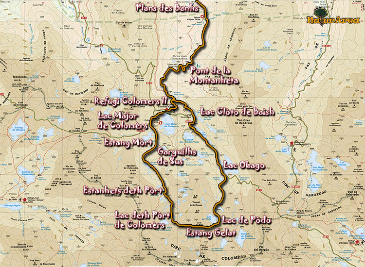
Location |
Valley of Aiguamog. Valley of Arán |
| Departure Point |
Salardú, going throught the valley Arriu de Aiguamog, Plan de Banhs |
| Arrival Point |
Plans de Banhs |
| Distance |
17Km (Total). Rountrip route, we start and arrive to Plan de Banhs |
| Approximate time |
7h |
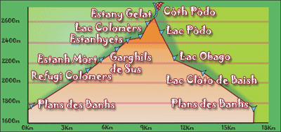
| Maximum height |
Coth deth Pòdo - 2600m |
Unevenness |
1063m |
| Difficulty |
High |
| Suitable timet |
June - October |
| Notes of interest |
In diverse points of the route the road disappears; you must be watchfull to the signs located throughout the journey if we don't want to get lost.
|
| GPS |
No
|
|
|
1/4 |
 |
|