| |
|
|
|
|
Location |
Garrotxa National Park |
| Departure Point |
Sant Feliu de Pallerols |
| Arrival Point |
Sant Feliu de Pallerols |
| Distance |
17Km (roundtrip) |
| Approximate time |
5h |
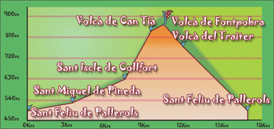
| Maximum height |
Fontpobra Volcano - 850m |
| Unevenness |
368m |
Cumulative Unevenness |
930m |
| Difficulty |
Middle |
| Suitable time |
All year |
| Notes of interest |
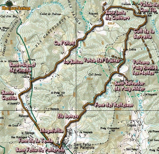
This route can be done on foot or in bicycle, there are some fountains on the road as well as mountain refuges where you can enjoy
the landscape.
This route can be done on foot or by bicycle, there are several fountains on the road and several castles (Castle Colltort, Castle Puig Alder ) and churches and some volcanoes like Can Tia, the Tuta, Fontpobra, Traité.
|
| GPS |
>>Download Track<<
|
|
|